
Land measurement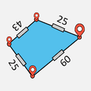
EasyArea
EasyArea turns a phone into a land measuring tool. Walk the boundary and let GPS record it, or trace the plot on a satellite map — then get the area in the unit you actually use.
1M+ downloads on Google Play.
What it does
Measure by walking
Walk the boundary of a field and EasyArea records the shape as you go.
Measure on the map
Tap points on a satellite map to trace a plot you cannot walk, and get the area instantly.
Local units
Results in the units people actually use on the ground, not just square metres.
Save and share
Keep your measurements and share them with anyone who needs them.